


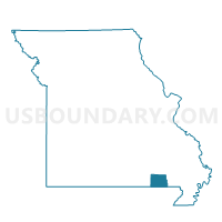
Harris Voting District, Ripley County, Missouri
About
Outline

Summary
| Unique Area Identifier | 609566 |
| Name | Harris Voting District |
| County | Ripley County |
| State | Missouri |
| Area (square miles) | 31.18 |
| Land Area (square miles) | 31.09 |
| Water Area (square miles) | 0.09 |
| % of Land Area | 99.71 |
| % of Water Area | 0.29 |
| Latitude of the Internal Point | 36.53587970 |
| Longtitude of the Internal Point | -90.75929190 |
Maps


Graphs
Select a template below for downloading or customizing gragh for Harris Voting District, Ripley County, Missouri


Neighbors
Neighoring Voting District (by Name) Neighboring Voting District on the Map
- Brown & Carpenter Voting District, Clay County, AR
- Doniphan P1, Ripley County, MO
- Little Black Voting District, Randolph County, AR
- Poynor & Current River Voting District, Ripley County, MO
- Thomas Voting District, Ripley County, MO
- Varner Voting District, Ripley County, MO
Top 10 Neighboring County Subdivision (by Population) Neighboring County Subdivision on the Map
- Doniphan township, Ripley County, MO (5,656)
- Thomas township, Ripley County, MO (871)
- Harris township, Ripley County, MO (744)
- Varner township, Ripley County, MO (657)
- Little Black township, Randolph County, AR (586)
- Brown-Carpenter township, Clay County, AR (411)
- Current River township, Ripley County, MO (216)
Top 10 Neighboring Unified School District (by Population) Neighboring Unified School District on the Map
- Doniphan R-I School District, MO (10,336)
- Corning Public Schools, AR (7,141)
- Maynard School District, AR (3,084)
- Naylor R-II School District, MO (1,844)
Top 10 Neighboring State Legislative District Lower Chamber (by Population) Neighboring State Legislative District Lower Chamber on the Map
- State House District 153, MO (35,762)
- State House District 80, AR (27,905)
- State House District 79, AR (24,175)
Top 10 Neighboring State Legislative District Upper Chamber (by Population) Neighboring State Legislative District Upper Chamber on the Map
- State Senate District 25, MO (169,588)
- State Senate District 11, AR (80,865)
- State Senate District 10, AR (80,214)
Top 10 Neighboring 111th Congressional District (by Population) Neighboring 111th Congressional District on the Map
Top 10 Neighboring Census Tract (by Population) Neighboring Census Tract on the Map
- Census Tract 8703, Ripley County, MO (4,329)
- Census Tract 9601, Randolph County, AR (4,306)
- Census Tract 8702, Ripley County, MO (2,958)
- Census Tract 8704, Ripley County, MO (2,522)
- Census Tract 9503, Clay County, AR (2,204)